Hiking through Brittany, France on the G34 Trail
Brittany is France’s largest peninsula, jetting far out into the Atlantic Ocean. It’s close proximity to the water makes it ideal for sailing, swimming, canoeing, and kayaking. The G34 trail that winds around the stunning coastline makes Brittany an incredible hiking destination as well. I myself love a good, long hike and have had the great pleasure of spending a fair amount of time on the trail.
This summer, for example, I found myself on the trail on four different occasions – in Moelan-sur-Mer, St. Briac, Saint Suliac, and Erquy. I would love to follow the entire route one day, which means covering over 2,000 kms in all (it is no wonder then, that the GR stands for Grande Randonnée or long hike). To do so at one go would make me fit as a fiddle, but would also take the better part of a month to six weeks. Yes, it would be physically challenging surely, but with exceptional ocean views, stops in charming villages, and partaking in the local cuisine along the way, it doesn’t sound like a bad way to spend a good chunk of time. For now, though, I will venture out on the trail whenever I can, taking it in small chunks as I have done over the years.
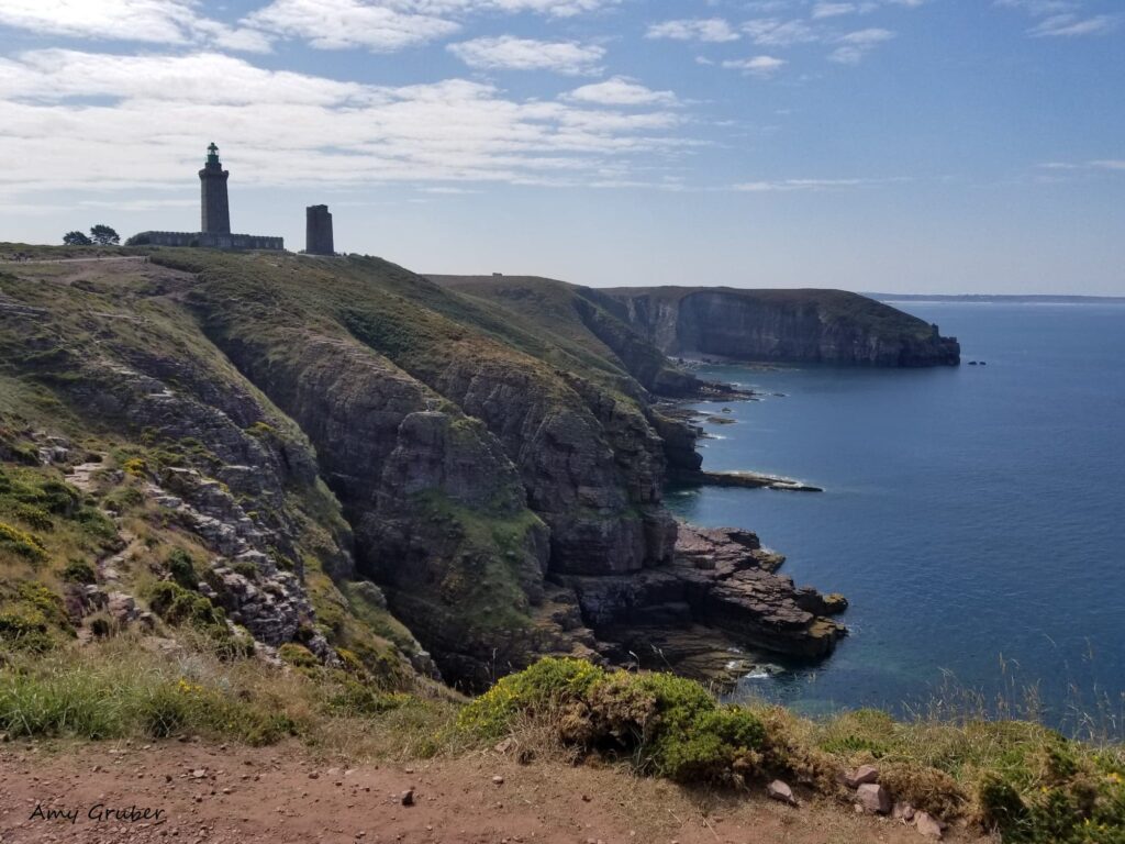
My first experience on the trail was back in 2017, when I visited Cap Fréhel and Fort la Latte. I was immediately smitten with the seemingly limitless spectacular views. Fort la Latte lies in the commune of Plévenon, in the Côtes-d’Armor department of northern Brittany. Cap Fréhel is about 4 km or 2.5 miles from Fort la Latte and one can easily walk between the two sites on the GR34 trail. It was at Cap Fréhel that I began to fully appreciate the beauty of the region and coasts. I can say that it was that trip, my second to that part of Brittany, that I knew I wanted to live there forever. (Link to post on
Please visit my following blog posts for additional information on visiting Fort La Latte and Cap Fréhel https://talesfrombrittany.com/visitor-guide-to-fort-la-latte-and-cap-frehel/
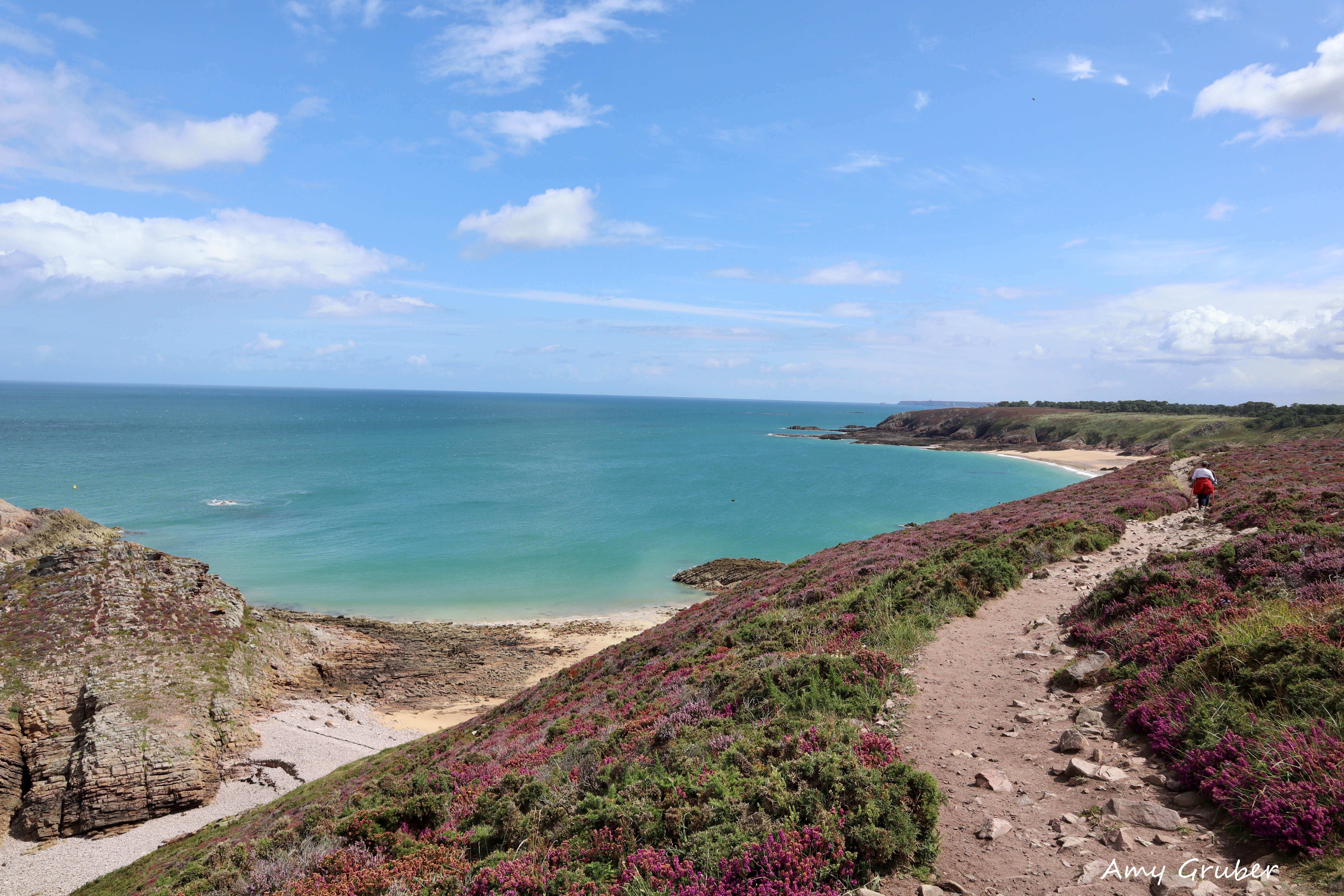
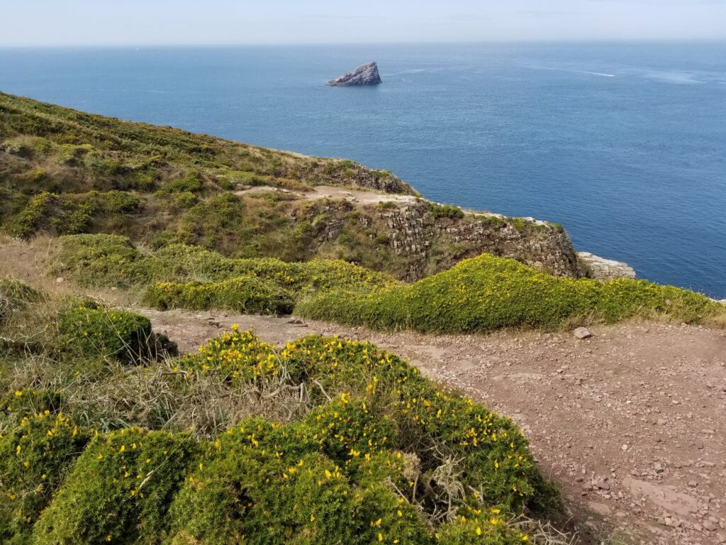
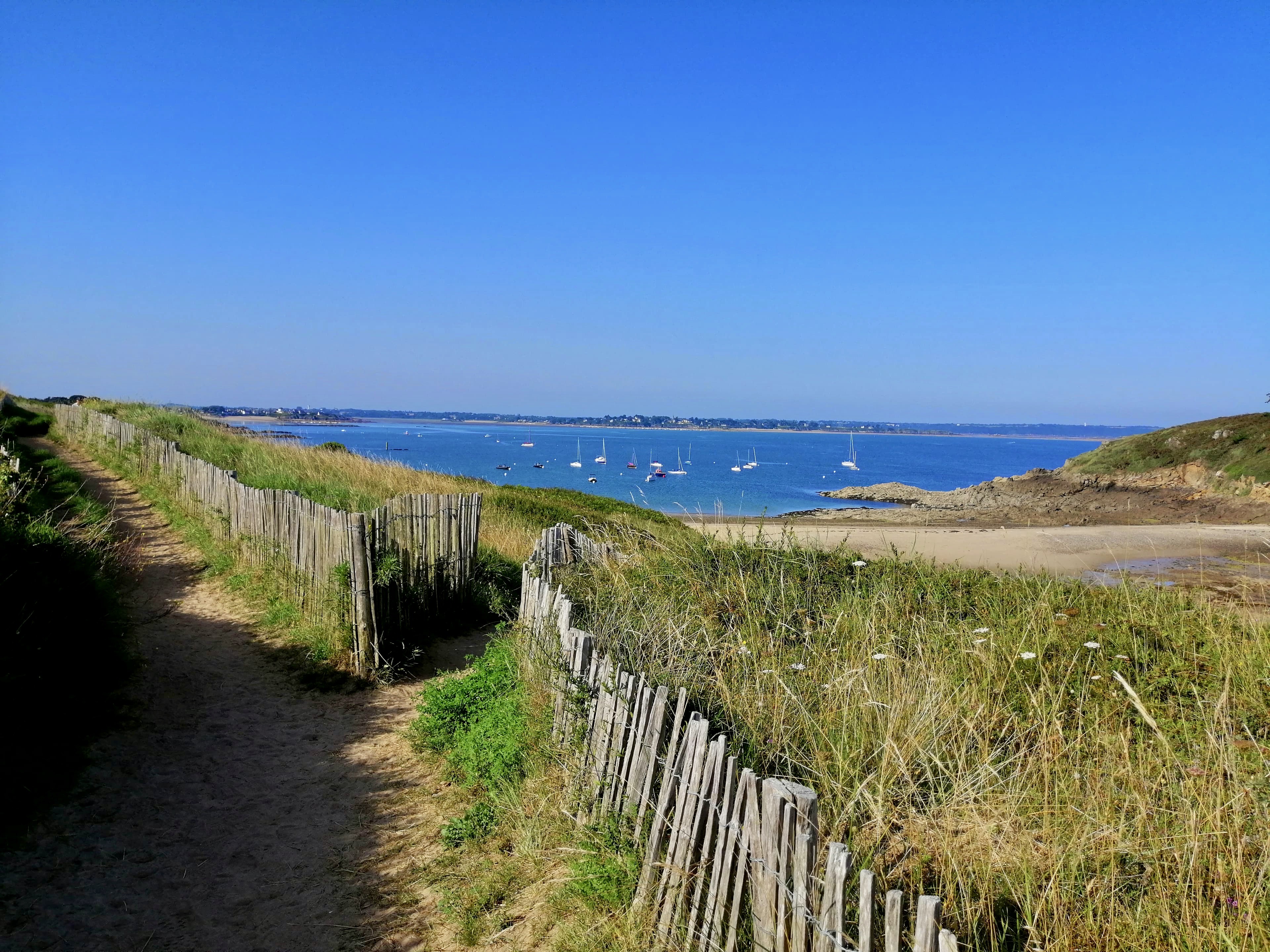
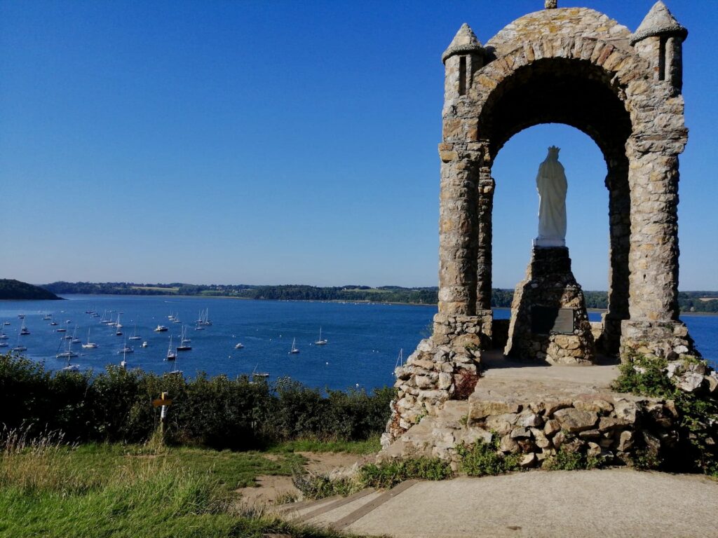
To experience Brittany’s coast on foot is a gift. The G34 has nonstop views of the sea. Immense cliffs jut out into the green waters that appear to come out of an artist’s palette. It is as if someone took every shade of blue and green and mixed them together to create the perfect hue.
I have three primary recommendations for a good hiking experience: wear comfortable shoes with good traction, bring a map, and start your hike early in the morning. When I hiked the G34 around St. Briac with a friend, we ventured out on a Saturday morning before 7:30 and were the first to hit the trail. The sun had risen shortly before our departure, and we found the grass still wet with dew. It was quite special to see the flickers of light dancing off the gentle ripples in the sea and the grass sparkling in the sunlight. On that particular day, we walked for about 3 hours, ending our journey near the town where fishermen have lived for centuries. We marveled at the lovely homes with and imagined what it would be like living so close to the water’s edge.
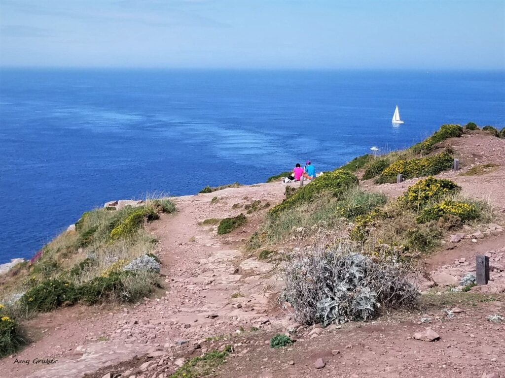
One of the things I love about hiking is the scenery. Another is breathing in the salty air of the sea. I also love feeling the wind on my face and hearing the seagulls flying above. The sights, smells, and sounds comfort me and I understand now why people who live by the sea can’t seem to move far from it.
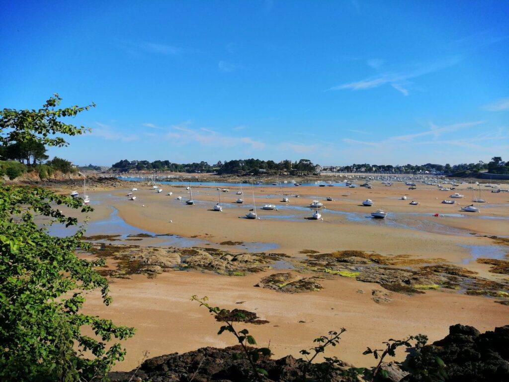
It is easy to get lost during a long hike, and I don’t just mean orientation. Hiking along the coastline, with all of its beauty, allows me time to be completely immersed in my surroundings. There is always a marvelous something just around the bend and drives me to keep going. During one randonnée, for example, my friend and I came up to a cliff and looked out at the numerous boats, lying on their sides, the tide long departed. They seemed to be snoozing while we trekked further and further. My friend had said that this was not the best time to view the bay, as it’s much nicer when it is high tide. In my opinion, though, there is something to be said for boats lying in waiting, and knowing that the moon has made sure that the tide will return when it is good and ready.
On my hikes, I often see families hitting the trails together, parents carefully pointing out where not to venture (such as protected areas, cliffs, and the like). It is not just for the young, however, as I see people of all ages walking together. While certainly more tourists take to the trails in the summer, I have seen people hiking in late fall too.
Do the French Enjoy Hiking?
According to Statista, published in July 2021:
64 percent of the French wanted to go hiking during their 2020 summer vacation. Hiking or walking is indeed a trendy sport in France, and the most practiced, far ahead of tennis or soccer.
In France, hiking is mostly practiced by older participants. The most numerous age group among the members of the Fédération Française de Randonnée is 65-69 years. Hiking was also the most common sports activity among French seniors, far ahead of swimming or cycling.
What to Know About the G34 Hiking Trail
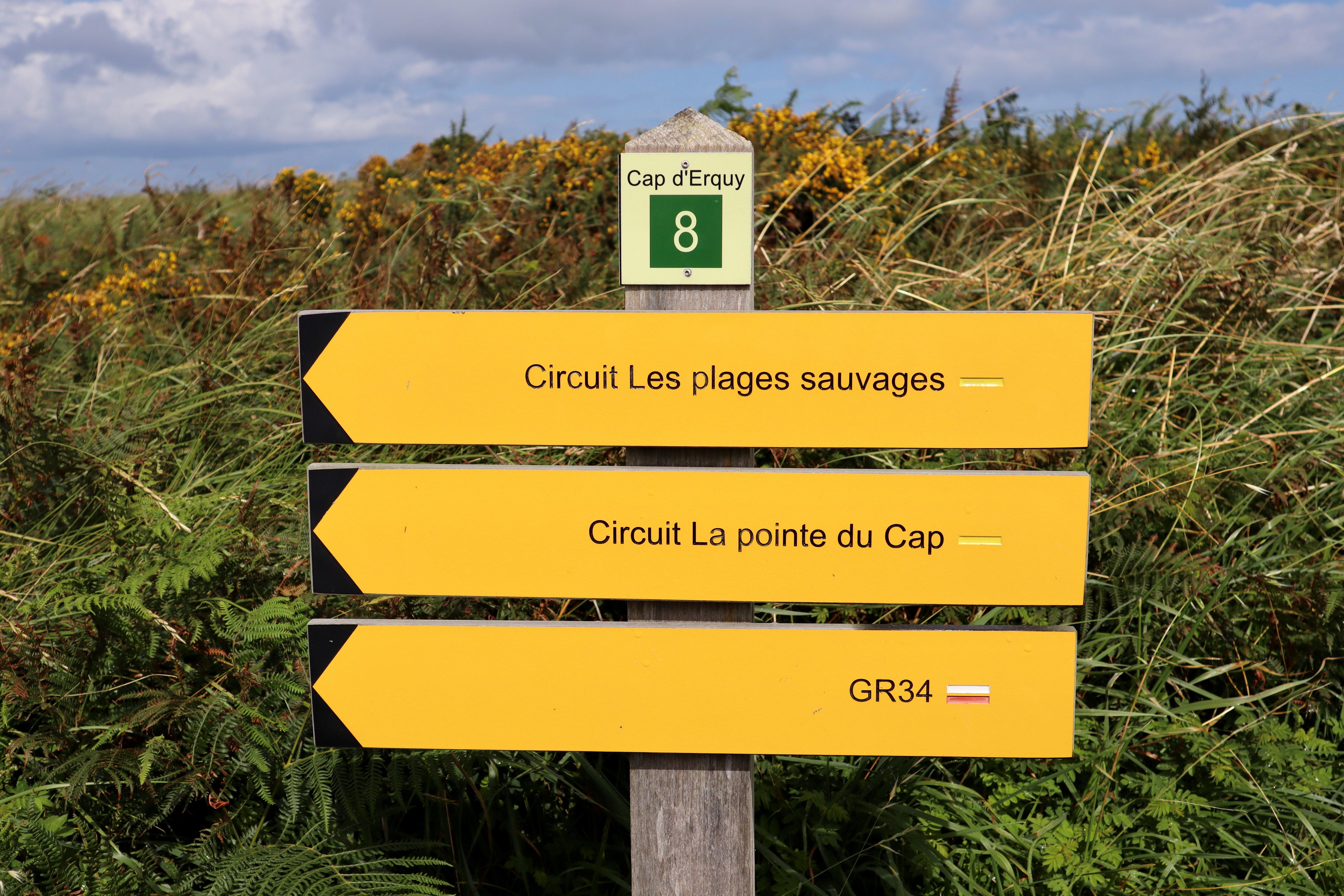
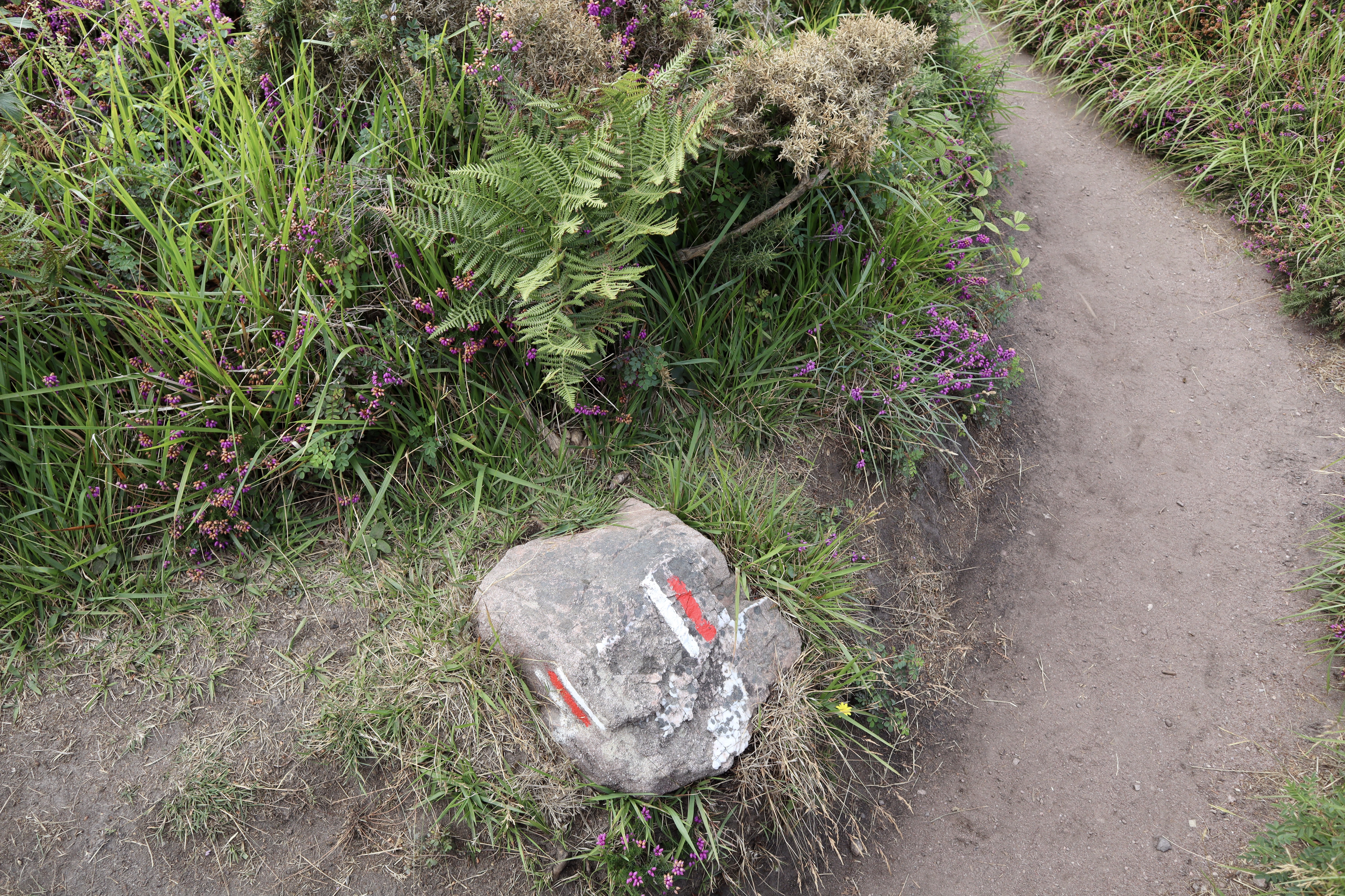
For first-time hikers, it may be good to know that the trails are clearly marked. You know immediately when you are on the G34 and when you’ve ventured off and branched into one of the many side trails. Truth be told, I have no sense of direction, so I appreciate this immensely.
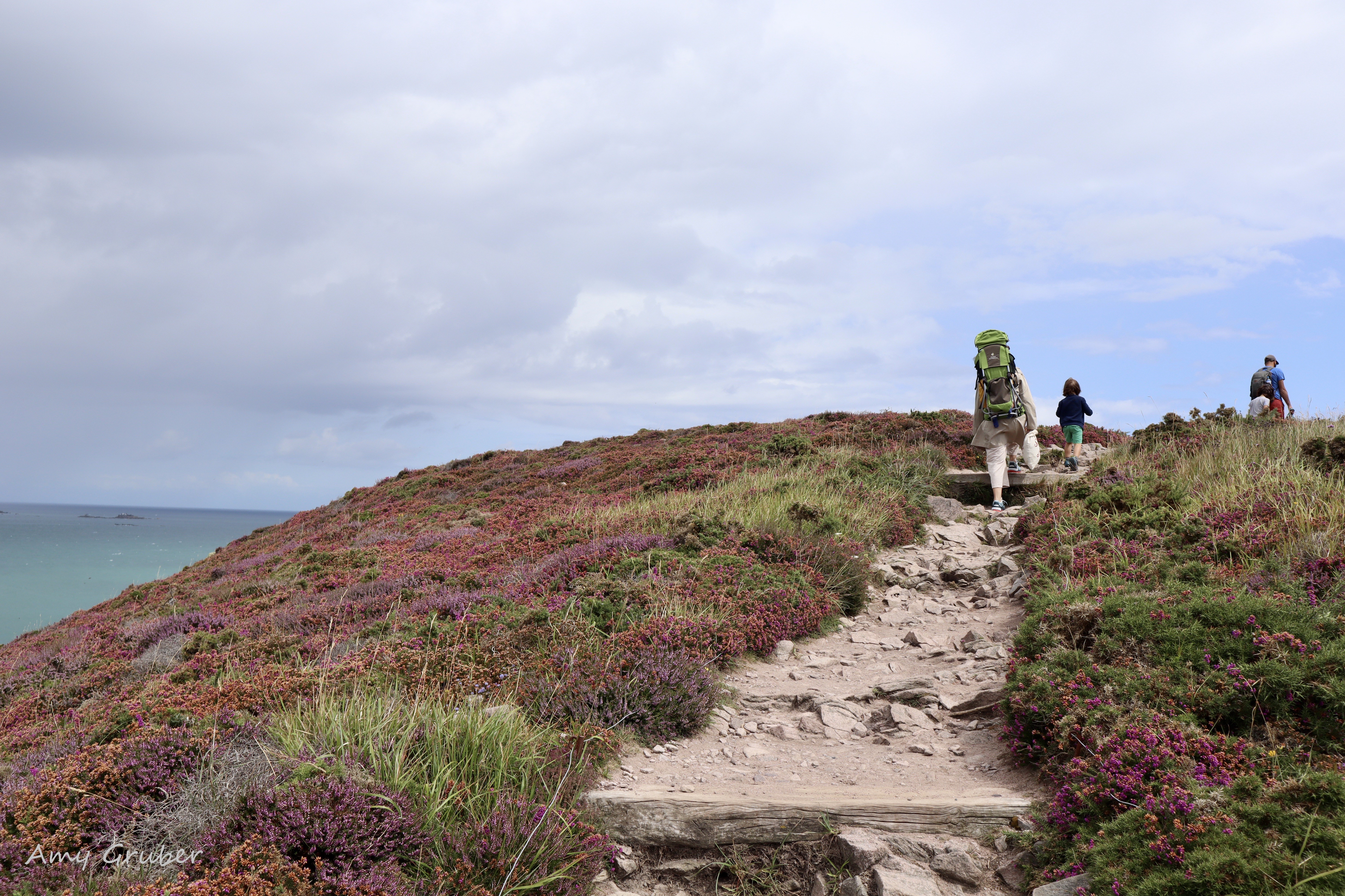
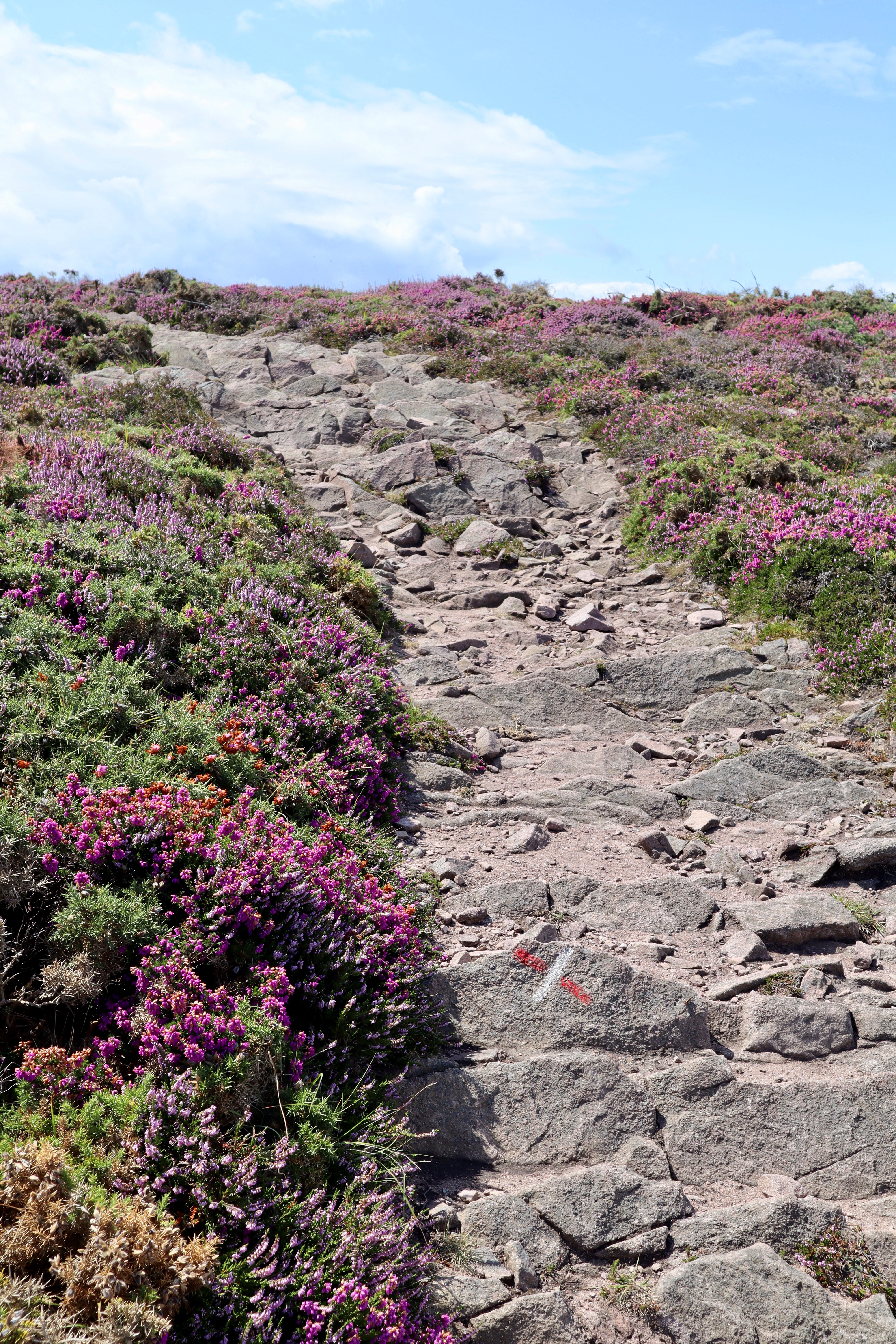
On one particular hike, my friend Christine and I decided to take a smaller trail leading us into the fields of wild heather. The deep purple next to the granite stones contrasted beautifully with the green-blue waters far beyond. It was, quite simply, breathtaking.
Map of G34 trail
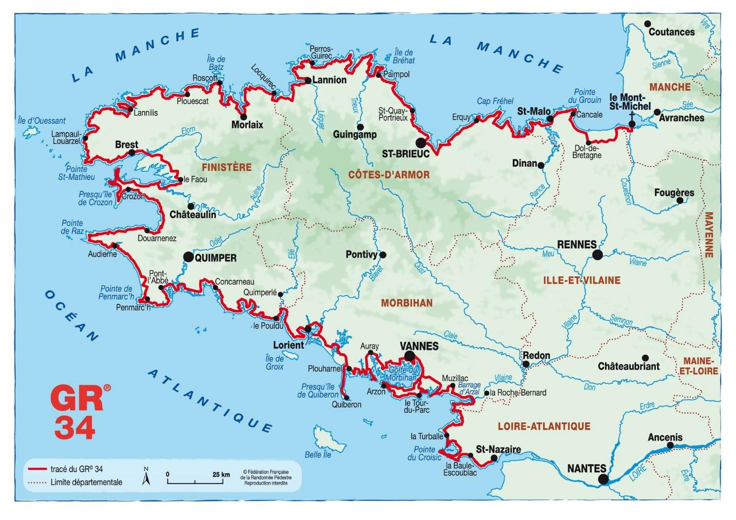
Map taken from: https://bretagne.ffrandonnee.fr/html/4037/randonner-sur-le-gr-34
Good to Know:
“Sentier des Douaniers” or Customs Officers Trail is clearly marked by two horizontal stripes, one red and one white, indicating that it is part of the GR 34 trail..
The trail begins in Mont St Michael and ends just outside Brittany in Saint-Nazaire in the Loire-Atlantique
There are no toilets on the trails. Be sure to hydrate, but make a pit stop before you start your trek.
While these trails are described as “good for all levels” I feel I have to disagree a bit, for they are rugged and can be steep at some times. It is best to exercise a good deal of caution, wear comfortable hiking shoes with good traction, and maybe bring a Band Aid or two.
Guides to HIking in Brittany, France:
Map of G34 trail https://www.gr-infos.com/en/gr34.htm
General information about the G34 (in French) https://bretagne.ffrandonnee.fr/html/4037/randonner-sur-le-gr-34
Hiking ideas booklet (in French) https://cms.ffrandonnee.fr/data/CR05/files/GR%2034/plaquette-id-randos-janvier-2020-bd.pdf
Hiking Trails in Brittany https://www.brittanytourism.com/matching-what-i-want/ideas/backpacking-the-five-essential-hiking-routes-in-brittany/
Light hiking in Brittany https://www.travelgeekery.com/hiking-in-brittany-france/
https://www.komoot.com/guide/16103/hiking-in-brittany
Hiking statistics https://www.statista.com/topics/7336/hiking-in-france/
Previous blog posts mentioned above:
Saint Suliac https://talesfrombrittany.com/a-visit-to-saint-suliac-bretagne-france/
Visiting Fort La Latte and Cap Fréhel https://talesfrombrittany.com/visitor-guide-to-fort-la-latte-and-cap-frehel/
A Coastal Drive in Brittanyhttps://talesfrombrittany.com/a-coastal-drive-in-brittany/
Hiking can be an incredible way to see a new area of France, such as Brittany. With a little pre-planning, good shoes, and a sense of adventure, it can be an experience not soon forgotten. Would you like to venture out onto the G34 trail?
Amy, from Tales from Brittany
6 Comments
Barbara J Gruber
Wonderful! Nice to take the trek through your eyes.
Amy G.
I’m glad you enjoyed it! Hope to take more hikes very soon XO
Heather Campbell-Lieberman
Definitely saving this installment for use later when I take my hubby to France💕
Amy G.
Absolutely! And let me know when you are on your way. I’ll put the coffee on!
Isabelle Gauthier
Les randonnées bretonnes sont toutes très belles, C est un plaisir de lire ton ressenti.
Amy G.
Merci Isabelle! J’ai hâte de faire une randonnée avec toi bientôt. XO